Weather
Cloud Categories

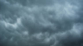
Low & Middle Clouds
The
Cumulus Cloud:
-
Cumulus clouds (aka fair weather clouds), are usually formed by condensation
-
How/Why does it form? Air over the ground is warmed by the sun during the day. That what it becomes ligther than its surrounding air, expands and ascends. During its ascend it will cool again (on a regular summer day). When the temperature reaches its dewpoint* water drops form out of the previously warm air. <> Condensation has occured. This process is also known as 'adiabatic cooling.
-
The described process is associated with unstable air (condt.)
* the point/temperature that a certain or given volume/paakage of air needs to reach, to become saturated, or to fully condense

The
Stratus Cloud:
-
Stratus clouds (indicator for stable atmospheric conditions) are often formed when a warm air mass (warm front) is moving over a cooler/cold air mass. The warm air is cooled from below and condenses as a thin layer of moisture <> rahter flat appearance
-
Stratus clouds also form with high pressure systems when air from above sinks towards colder air → pressure increases → warms adiabatically
-
The word stratus comes from Greek, meaning “layer/blanket”

The
Cirrus Cloud:
-
Consists of tiny ice particles/crystals, as it forms at very high altitudes only.
-
Is a good indication of upper level weather (systems) and present moisture.

The
Cumulunimbus Cloud:
-
Cumulunimbus Cloud (CB) is a Thunderstorm Cloud (Indicator).
-
It can extend vertically to extreme heights like 35,000 feet and above.
-
The higher they extend the stronger their up/down currents within the clouds.
should be avoided at all times!


FOG
-
Fog = Cloud?
-
YES, sort of! - It forms in the same way as a cloud does (temperature reaches it's dewpoint <> water droplets form).
-
Provided that there's a little bit of wind (~10-15 kts), fog can be lifted to a certain height above the ground, which can result in a Low Stratus Cloud.
-
Also, do not confuse Fog and Haze. Fog is very moist or wet, while Haze is not!
-
Since air can become saturated in different ways, there are also different kinds of Fog,named by the way they form:
-
Radiation* Fog
→ forms during the early morning when the ground (often times black tarmac) releases heat from the previous day. Air just above the ground is usually colder at this time → the warmer air cools down and becomes saturated.
-
*the release of heat off the ground (warm moist rising air)
-
Advection Fog
→ warmer air moves over colder ground
-
Steam Fog
→ colder air is/moves over warmer water or VICE VERSA
-
Upslope Fog
→ warm is being forced up a mountain, thus becomes automatically saturated due to cooling down.
-
Precipitation Induced Fog
→ when upper level precipitation (rain) falls through a colder layer of air near the ground, precipitation will end up as small moisture particles only just above the ground or below the clouds (can be assoc. with a cold front moving over warmer air)

How to differ between a Cloud & Fog?
FOG is present when the visibility is less than (<) or drops below 1km/~3000ft. Above that value, it's often considered a Stratus Cloud.
What is adiabatic cooling?
It exists if we have no Transfer of Heat between rising and it's surrounding air.
So, what is meant with transfer of heat?
-
Air can cool down faster or slower. That depends on how much water a certain/given amount of air holds (relative humidity). If the humidity is high (~ 70% or more) in a given amount of air, it would then be 70% saturated. In other words, it would only take about 30% more for this amount of air, in order to become visible as tiny water particles ( a cloud).
-
Moist air cools down (depending on it's saturation/moisture level) approximately about 1 deg. Celsius/1000ft.
-
If the humidity is lower (~ 50% or less) it cools down faster as it rises, approximately about 3 deg Celsius/1000ft. These processes are known as adiabatic cooling.
-
Pilots usually take the average/middle of 2 deg Celsius/1000ft to calculate difference between standard and actual temperature at heights for different things such as aircraft performance or other things.
-
Again, visible moisture, such as the base of clouds are a good indication of the current
saturation level. Air starts to become saturated, if the 'Temperaure/Dewpoint Spread' is between 1-3 degress Celsius.